Finike
Finike, the ancient Phoenix or Phoinix (Φοῖνιξ), also formerly Phineka, is a town and a district on the Mediterranean coast of Antalya Province in Turkey, to the west of the city of Antalya, along the Turkish Riviera. It is located on the southern shore of the Teke peninsula, and the coast here is a popular tourist destination. However, Finike is best known for its oranges, the symbol of the town.
For centuries Finike, then named Phoenix (or Phoinix; Φοῖνιξ) was a port town of ancient Lycia, near the mountain of the same name. It was a trading port and the main port of Limyra, the capital city of Lycia. Phoenix was said to have been founded by Phoenicians in the 5th century BC, and thus named after its founders.
The area has been inhabited for much longer than that; archaeologists have found evidence near the town of Elmalı showing that the Teke peninsula has been settled since 3000 BC (although on the coast nothing has been uncovered dating before 2000 BC).
Trade along the coast was established first by the Persians, who relinquished Lycia to the armies of Alexander the Great. However, the coast was always vulnerable to forces from Syria, Egypt and Rhodes until it was brought within the empire of the Ancient Romans and the succeeding Byzantines. Even then the Byzantines were threatened by the Arabian armies coming from the Arabian Peninsula. The Battle of the Masts between the Arab and Byzantine fleet took place near Finike in 654. Eventually the area was lost to the Seljuk Turks in the 13th century. These were succeeded by the Ottoman Empire from 1426.
The town was inhabited by Greeks prior to the 1923 population exchange between Greece and Turkey.
Map - Finike
Map
Country - Turkey
 |
|
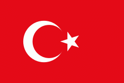
| Flag of Turkey | |
One of the world's earliest permanently settled regions, present-day Turkey was home to important Neolithic sites like Göbekli Tepe, and was inhabited by ancient civilisations including the Hattians, Hittites, Anatolian peoples, Mycenaean Greeks, Persians and others. Following the conquests of Alexander the Great which started the Hellenistic period, most of the ancient regions in modern Turkey were culturally Hellenised, which continued during the Byzantine era. The Seljuk Turks began migrating in the 11th century, and the Sultanate of Rum ruled Anatolia until the Mongol invasion in 1243, when it disintegrated into small Turkish principalities. Beginning in the late 13th century, the Ottomans united the principalities and conquered the Balkans, and the Turkification of Anatolia increased during the Ottoman period. After Mehmed II conquered Constantinople (Istanbul) in 1453, Ottoman expansion continued under Selim I. During the reign of Suleiman the Magnificent, the Ottoman Empire became a global power. From the late 18th century onwards, the empire's power declined with a gradual loss of territories. Mahmud II started a period of modernisation in the early 19th century. The Young Turk Revolution of 1908 restricted the authority of the Sultan and restored the Ottoman Parliament after a 30-year suspension, ushering the empire into a multi-party period. The 1913 coup d'état put the country under the control of the Three Pashas, who facilitated the Empire's entry into World War I as part of the Central Powers in 1914. During the war, the Ottoman government committed genocides against its Armenian, Greek and Assyrian subjects. After its defeat in the war, the Ottoman Empire was partitioned.
Currency / Language
| ISO | Currency | Symbol | Significant figures |
|---|---|---|---|
| TRY | Turkish lira | ₺ | 2 |
| ISO | Language |
|---|---|
| AV | Avar language |
| AZ | Azerbaijani language |
| KU | Kurdish language |
| TR | Turkish language |


